AGRICULTURAL
DRONE SERVICES
IN RALEIGH & NC

Drone Studio NC • Raleigh, NC

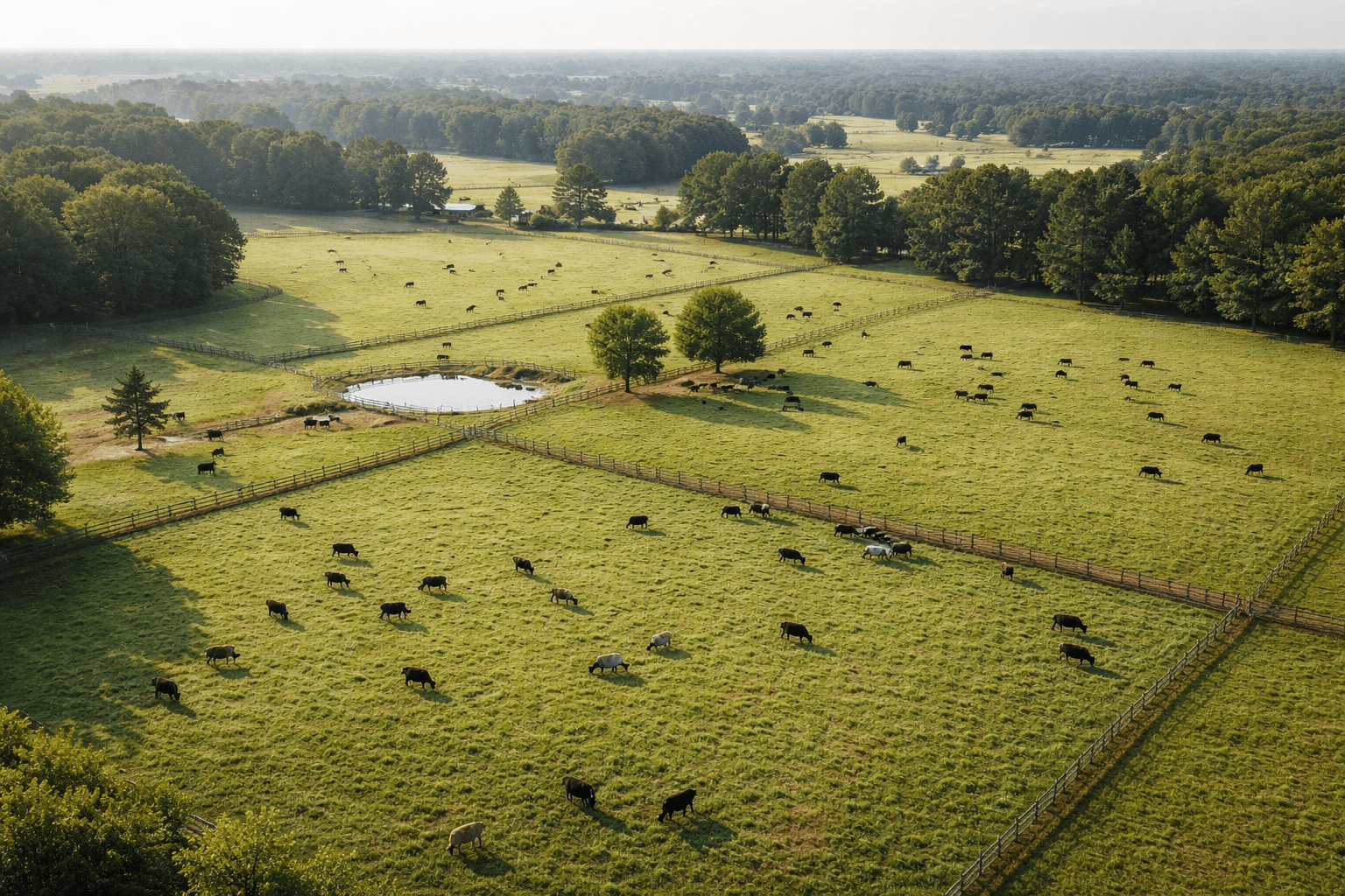
Drone Studio NC provides professional agricultural drone services across Raleigh, the Triangle, and throughout North Carolina. From crop health monitoring and field mapping to infrastructure inspections and precision aerial photography, our FAA-certified pilots deliver the aerial data and visual content that NC farmers, growers, and land managers need to optimize operations, reduce input costs, and make smarter decisions from planting through harvest. Whether you manage row crops in the Coastal Plain, vineyards in the Yadkin Valley, livestock operations in the Piedmont, or timber acreage in the NC mountains, our professional drone services are designed to help your agricultural business thrive.

Our Agricultural Drone Services

WHAT WE DELIVER

A full suite of agricultural drone services designed to help North Carolina farmers and land managers make data-driven decisions from above.
Vast-crop-fields-in-rural-North-Carolina.png
01 Service

CROP HEALTH
MONITORING

Our agricultural drone services include advanced multispectral and NDVI imaging that reveals crop health issues invisible to the naked eye. Drone Studio NC captures detailed aerial data across your North Carolina fields that identifies nutrient deficiencies, pest damage, irrigation problems, and disease pressure weeks before they become visible at ground level. Farmers across the NC Piedmont, Coastal Plain, and Triangle use our crop scouting data to make targeted treatment decisions that reduce chemical usage, improve yields, and protect their bottom line throughout the growing season.
02 Service

FIELD MAPPING
AND SURVEYS

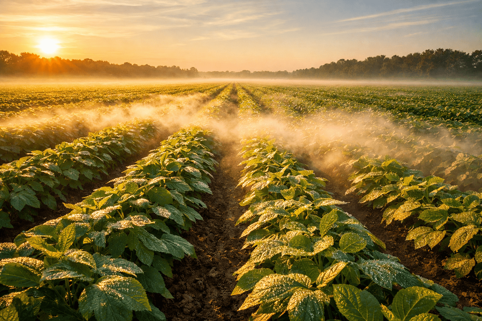
Accurate field mapping is the foundation of precision agriculture. Drone Studio NC produces high-resolution orthomosaic maps, elevation models, and topographic surveys that give farmers and land managers across North Carolina a complete aerial picture of their operation. Our surveying and mapping drone services deliver georeferenced data compatible with your farm management software, enabling variable-rate prescriptions, drainage planning, field boundary verification, and conservation compliance documentation for USDA and state programs.

03 Service

PRECISION
APPLICATION

Reduce chemical usage and improve application accuracy with drone-based precision spraying and seeding services. Our agricultural drone services leverage GPS-guided flight paths and variable-rate prescription maps to apply inputs exactly where they are needed across your NC fields — minimizing waste, reducing environmental impact, and lowering your per-acre costs. Ideal for targeted herbicide application, cover crop seeding, and spot treatments on North Carolina farming operations of any scale.
The Precision Agriculture Advantage

FARMS USING DRONE TECHNOLOGY
REDUCE INPUT COSTS BY UP TO 25%

Source: USDA Agricultural Research Service
Why Drone Studio NC

TRUSTED AGRICULTURAL
DRONE SERVICES
IN NORTH CAROLINA

North Carolina farmers and agribusinesses trust Drone Studio NC because we combine precision agriculture drone technology with a genuine understanding of agricultural operations and the unique growing conditions across the state. Our FAA Part 107 certified pilots know how to work around planting schedules, weather windows, and the practical realities of farming. Whether you need seasonal crop scouting, one-time field mapping, farm aerial photography for marketing or estate purposes, or drone inspections of barns, silos, and irrigation infrastructure, we deliver reliable data your operation can act on immediately.

100+

Farms Served

50K+

Acres Mapped

FAA

Certified Pilots

5.0★

Google Rating

How It Works

FROM PLANTING
TO HARVEST

01

Plan Your Program

Share your operation details including field locations across North Carolina, crop types, total acreage, and the specific challenges you are facing this season. We design a custom agricultural drone services program around your growing calendar, field conditions, and data requirements — whether that is a single scouting flight near Raleigh or a full-season monitoring program covering thousands of acres across the NC Piedmont.

02

We Scout and Map

Our FAA-certified pilot flies your North Carolina fields with professional-grade multispectral sensors and mapping equipment. We capture detailed aerial data covering crop health, field topography, drainage patterns, and vegetation indices across your entire operation in a fraction of the time traditional scouting methods would require.

03

You Grow Smarter

Receive processed field maps, crop health reports, and variable-rate prescription files within 48 hours via secure cloud delivery. Load the data directly into your farm management software, share it with your agronomist or crop consultant, and make targeted decisions that optimize every acre of your North Carolina operation.

OPERATIONS WE SERVE

AGRICULTURAL DRONE SERVICES
FOR EVERY OPERATION

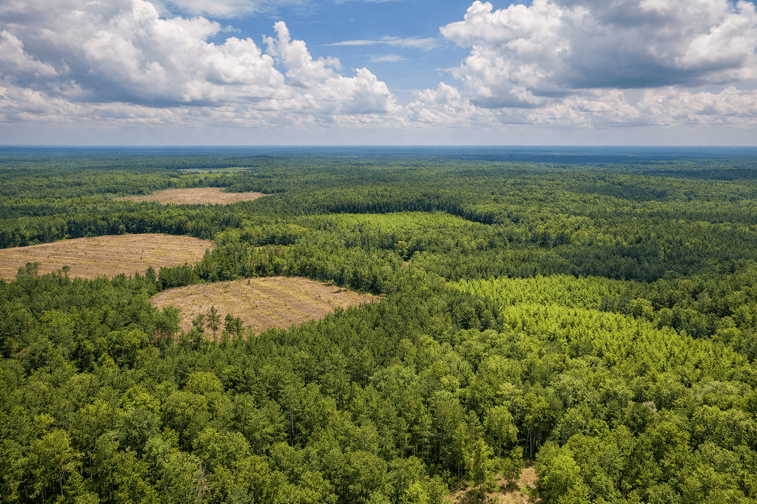
From row crops and specialty produce to timber and livestock, our agricultural drone services help North Carolina growers and land managers across every operation type make better decisions with precision aerial data. Each operation below represents a core area of our agricultural coverage across Raleigh, the Triangle, the Piedmont, Coastal Plain, and mountain regions of NC.

Row Crops

Corn, soybeans, wheat, cotton, and tobacco field monitoring with NDVI analysis, stand counts, and variable-rate prescription mapping for precision input management on North Carolina row crop operations.

Specialty Crops

Vineyard, orchard, and greenhouse operations across NC benefit from targeted aerial scouting that identifies stress patterns, monitors canopy development, and optimizes spray applications throughout the season.

Livestock

Aerial herd monitoring, pasture health assessment, fence line inspection, and grazing rotation planning for cattle and livestock operations across North Carolina farmland.

Timber and Forestry

Forest inventory, timber volume estimation, and land management planning with high-resolution aerial mapping and canopy analysis for NC timber and forestry operations.

Land Management

Soil erosion monitoring, conservation compliance documentation, and environmental assessment for North Carolina farms participating in USDA, NRCS, and state conservation programs.

Research Plots

Aerial data collection for university research trials, seed company test plots, and agricultural technology field demonstrations at NC State and other North Carolina research institutions.
Recent Work

AGRICULTURAL DRONE
SERVICES PORTFOLIO

A curated selection of recent agricultural drone services projects completed across North Carolina. Our portfolio features crop health mapping for row crop operations, precision field surveys for land managers, aerial photography for farm marketing and real estate listings, infrastructure inspections for agricultural facilities, and seasonal monitoring programs for NC growers. Explore our other services including commercial drone services and surveying and mapping for additional solutions.

Book your drone service

Project location

Enter the address or venue where drone services will be performed.

We handle all FAA airspace authorizations including LAANC approvals near RDU at no extra charge. If your site has special access requirements, our coordinator will confirm all details before the flight date.

Build your package

Select one or more services for . Add extras below.

Add-ons & extras

Your details

Confirm & pay deposit

Review your booking and pay the 50% deposit to confirm.

Payment details
Secured by Stripe — 256-bit SSL encryption

By clicking "Pay deposit," you agree to Drone Studio NC's terms of service. Your 50% deposit is non-refundable within 72 hours of the scheduled flight.

Booking confirmed

Questions? Email info@dronestudionc.com