
Drone Studio NC • Raleigh, NC
Drone Studio NC provides professional commercial drone services across Raleigh, the Triangle, and throughout North Carolina. Our FAA-certified pilots serve businesses and organizations in agriculture, construction, and real estate and insurance with a comprehensive suite of aerial solutions — from aerial photography and videography and precision surveying and mapping to thorough drone inspections and beyond. Whether you manage agricultural land in the NC Piedmont, oversee construction projects in Wake County, or handle real estate listings and insurance claims across the Triangle, our commercial drone services deliver the precision aerial data and visual content your business needs to operate more efficiently, reduce costs, and gain a measurable competitive advantage.
Our commercial drone services include professional aerial photography and cinematic 4K videography designed for businesses across Raleigh and North Carolina. We create compelling aerial content for real estate agents marketing Triangle listings, insurance companies documenting property conditions, construction firms showcasing completed projects, and agricultural operations capturing field imagery for stakeholder reports. Every shoot is planned with your specific business objectives in mind — whether that means creating MLS-ready listing photos for a Raleigh brokerage, producing cinematic video tours for a commercial development in Cary, documenting crop conditions for an NC farming operation, or capturing aerial marketing content for a corporate campus in Research Triangle Park. Our commercial clients trust us because we combine deep technical drone expertise with a professional production workflow that consistently meets the quality standards and tight deadlines that business projects demand.
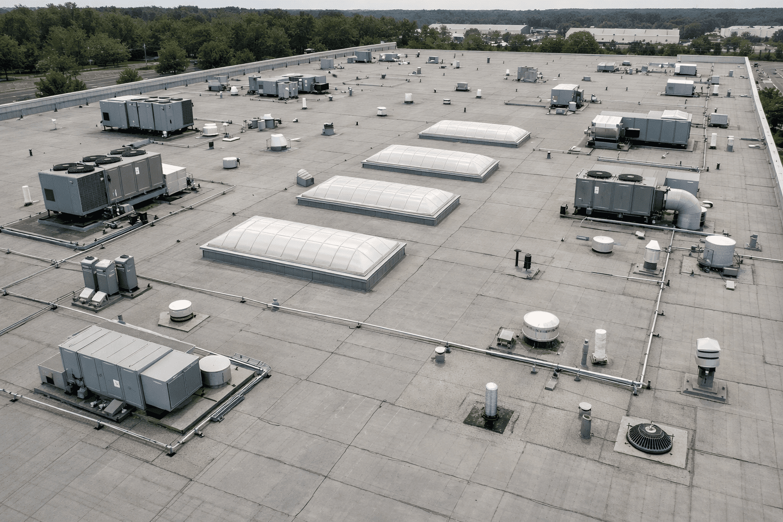
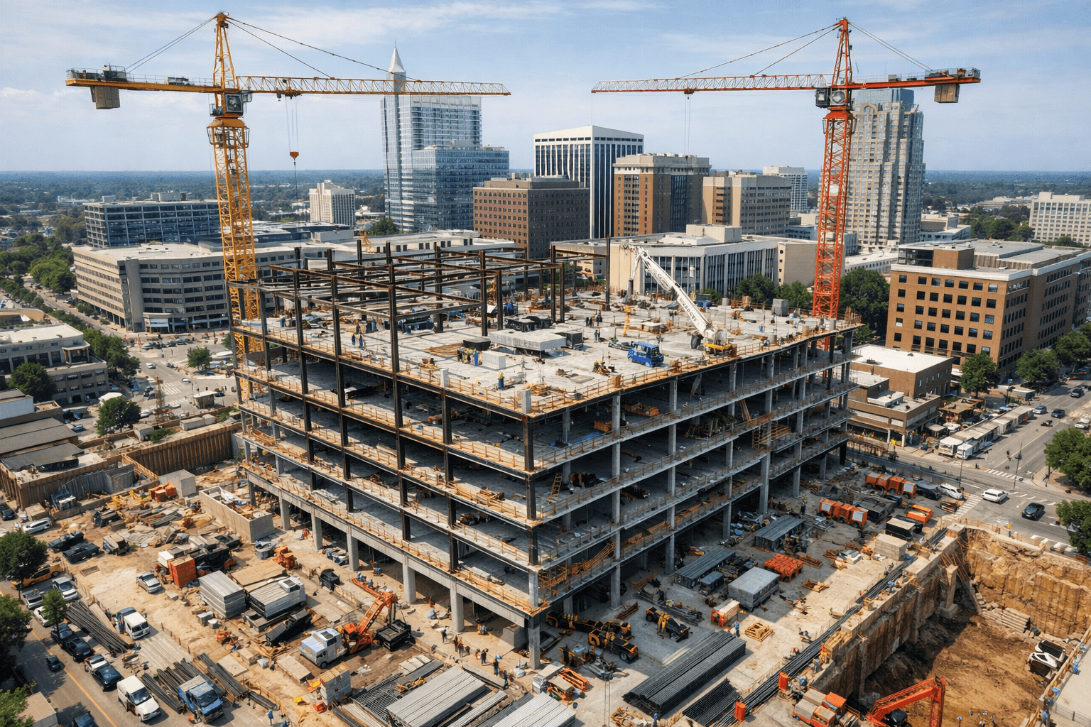
Reduce risk and eliminate the need for scaffolding, boom lifts, and manual inspections at height across your commercial properties and infrastructure. Our commercial drone inspection services include comprehensive visual and radiometric thermal assessments for rooftops, building facades, cell towers, construction sites, agricultural structures, and real estate properties across Raleigh and North Carolina. Insurance professionals rely on our detailed aerial documentation for property claims and risk assessments throughout the Triangle. Construction managers use our inspection reports to identify safety issues and track project quality across NC job sites. Agricultural clients benefit from aerial crop scouting and infrastructure condition assessments on their North Carolina properties. Every inspection delivers annotated high-resolution imagery, calibrated thermal diagnostics, and prioritized maintenance recommendations that help your business protect assets and maintain compliance.
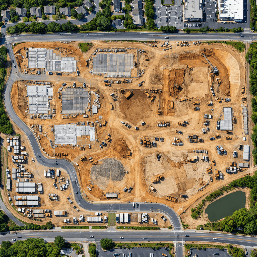
Accurate geospatial data is the foundation of smart business operations and informed decision-making across agriculture, construction, and real estate. Our commercial surveying and mapping drone services deliver high-accuracy orthomosaic maps, topographic surveys, 3D terrain models, and precise volumetric measurements for construction development sites, agricultural fields, commercial real estate properties, and insurance documentation projects across North Carolina. Drone Studio NC produces georeferenced datasets that integrate directly with AutoCAD, ArcGIS, and BIM platforms, giving engineers, project managers, farm operators, and real estate professionals the spatial intelligence they need to plan expansions, monitor construction progress, optimize agricultural operations, and document property conditions for appraisals and claims. We complete commercial aerial surveys up to five times faster than traditional ground-based methods while maintaining survey-grade accuracy your team can rely on.
Why Businesses Choose Drone Studio NC
Businesses across agriculture, construction, and real estate and insurance throughout the Triangle choose Drone Studio NC as their commercial drone services provider because we deliver professional aerial solutions with the reliability, accuracy, and local expertise that North Carolina organizations require. Every project is managed by experienced professionals who understand the unique demands of each industry we serve — from the seasonal timing requirements of agricultural drone flights to the safety protocols on active construction sites and the documentation standards insurance adjusters and real estate appraisers expect. Our FAA Part 107 certified pilots carry comprehensive liability insurance, handle all airspace authorizations for flights in the Raleigh-Durham area, and follow standardized operational procedures that ensure consistent, high-quality results on every commercial engagement across NC.
A curated selection of recent commercial drone services projects completed for business clients across Raleigh, Durham, Research Triangle Park, Cary, and the greater Triangle area. Our portfolio showcases professional aerial content for real estate brokerages and insurance firms, construction site surveys and progress documentation for general contractors, agricultural field mapping and crop analysis for NC farming operations, thermal inspections for commercial property managers, and aerial photography for businesses throughout North Carolina who rely on Drone Studio NC to deliver commercial-grade aerial solutions.
Partner with Drone Studio NC for commercial drone services that deliver measurable results for your business. We provide professional aerial solutions for agriculture, construction, and real estate and insurance organizations across Raleigh and throughout North Carolina. Contact us today for a free consultation and custom project proposal. You can also explore our dedicated service pages for aerial photography and videography, drone inspections, and surveying and mapping to learn more about each solution we offer.
Enter the address or venue where drone services will be performed.
Select one or more services for . Add extras below.
Review your booking and pay the 50% deposit to confirm.
By clicking "Pay deposit," you agree to Drone Studio NC's terms of service. Your 50% deposit is non-refundable within 72 hours of the scheduled flight.
Questions? Email info@dronestudionc.com