If you need aerial photography or video in the Raleigh area, the options can feel overwhelming fast. Drone photography services in Raleigh NC have expanded quickly over the past few years, covering everything from real estate listings and weddings to commercial construction sites and infrastructure inspections. The right provider makes a real difference in the quality of your deliverables, the speed of turnaround, and whether the work is done legally.
This guide covers every major use case, what local pricing looks like, what questions to ask before you hire, and why FAA certification matters for any commercial project in Wake County.
Key Takeaways
- FAA Part 107 certification is required — any commercial drone pilot operating in Raleigh must hold this license or your project could face legal and insurance complications.
- Pricing varies by use case — expect $150–$500 for real estate shoots, $400–$1,500 for events, and $800–$3,000+ for inspections and construction monitoring.
- Turnaround times range from 24 to 72 hours for most photography and video projects, with inspection reports taking longer due to analysis requirements.
- Raleigh airspace has regulated zones — RDU International Airport and several helipads create controlled airspace that requires LAANC authorization before flying.
- Always verify insurance — a qualified commercial drone operator should carry liability coverage of at least $1 million per occurrence.
- Different use cases need different equipment — real estate needs cinematic cameras, inspections need thermal sensors, and mapping needs RTK GPS units.
What Are Drone Photography Services and Why Do They Matter in Raleigh?
Quick Answer: Drone photography services use FAA-licensed pilots and commercial-grade UAVs to capture aerial images and video for real estate, events, construction, and inspections. In Raleigh, demand is driven by rapid urban growth, active real estate markets, and expanding commercial development across Wake County.
Raleigh is one of the fastest-growing metros in the Southeast. New residential subdivisions, mixed-use developments, and commercial campuses are going up across the region constantly. That growth creates real demand for aerial content across multiple industries.
Real estate agents need aerial photography to show off large lots and neighborhood context. Event planners want cinematic drone video for weddings and corporate gatherings. Construction managers need progress documentation. Utilities and property owners need detailed roof and infrastructure inspections. One service category — drone photography and videography — serves all of them, but the execution is very different for each.
What Are the Main Use Cases for Drone Services in Wake County?
Quick Answer: The most common uses in Wake County are real estate photography, event coverage, construction site monitoring, roof and structural inspections, and aerial mapping. Each use case requires different camera equipment, flight planning, and post-production workflows.
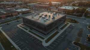
Real Estate Drone Photography
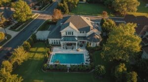
Real estate is the highest-volume use case for local drone pilots. Aerial photos and video add context that ground-level photos simply cannot provide. A wide-angle aerial shot of a five-acre lot tells a story in seconds. Drone footage showing proximity to schools, parks, or highway access helps buyers understand location value instantly.
Listings with aerial imagery tend to generate more online engagement. For luxury properties, custom subdivisions, and commercial real estate listings in the Triangle, professional real estate drone services have become a standard part of the marketing package rather than an optional add-on.
Event Drone Photography and Videography
Weddings, corporate events, and private celebrations all benefit from aerial coverage. A bird’s-eye view of a ceremony venue, an estate property, or an outdoor festival creates content that stands apart from traditional event photography. Event drone work requires a pilot who can fly safely around crowds, coordinate with other vendors, and deliver polished cinematic footage.
Events in urban Raleigh venues often require LAANC authorization (Low Altitude Authorization and Notification Capability) due to nearby controlled airspace. A qualified provider handles this before the event date, not the morning of.
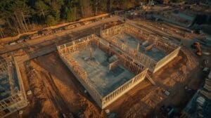
Construction Site Monitoring
General contractors and project owners use drone photography for scheduled site documentation. Weekly or bi-weekly aerial flyovers create a visual record of progress. This protects against disputes, supports draw requests, and gives stakeholders a reliable view of site conditions without requiring an in-person visit.
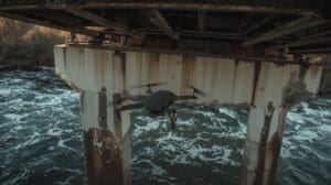
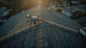
Roof, Structural, and Infrastructure Inspections
Drone inspections reduce the need for ladders, lifts, and scaffolding. A drone can document a commercial roof in minutes, capturing high-resolution images of every section. Thermal imaging sensors detect moisture intrusion, HVAC inefficiencies, and electrical hot spots that standard cameras miss entirely. Commercial drone inspection services typically include a structured report with annotated images, not just raw footage.
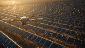
Aerial Mapping and Surveying
Land developers, civil engineers, and environmental consultants use drone mapping to generate accurate topographic data, orthomosaic maps, and 3D terrain models. This is a specialized service that requires RTK GPS-equipped drones and photogrammetry software. Turnaround on mapping deliverables is longer than standard photography — typically three to seven business days depending on site size and output type.
How Much Do Drone Photography Services in Raleigh NC Cost?
Quick Answer: Raleigh drone service pricing ranges from $150 for basic real estate shoots to $3,000+ for multi-day inspections or mapping projects. Pricing depends on project type, flight duration, deliverable format, and whether specialized sensors or equipment are required.
| Service Type | Typical Price Range | Turnaround Time | Deliverables |
|---|---|---|---|
| Residential Real Estate | $150–$350 | 24–48 hours | 10–25 edited photos, 1–2 min video |
| Commercial Real Estate | $300–$700 | 24–72 hours | 20–40 edited photos, cinematic video |
| Wedding / Event Coverage | $400–$1,500 | 3–7 days | Highlight reel, full event footage |
| Construction Monitoring (per visit) | $250–$600 | 24–48 hours | Progress photos, date-stamped video |
| Roof / Structural Inspection | $300–$900 | 48–72 hours | Annotated report, high-res images |
| Aerial Mapping / Survey | $800–$3,000+ | 3–7 business days | Orthomosaic, DEM, 3D model |
Rush fees typically add 20–35% to the base rate. Repeat clients on retainer contracts (such as monthly construction monitoring) usually receive 10–20% discounts compared to one-off project pricing.
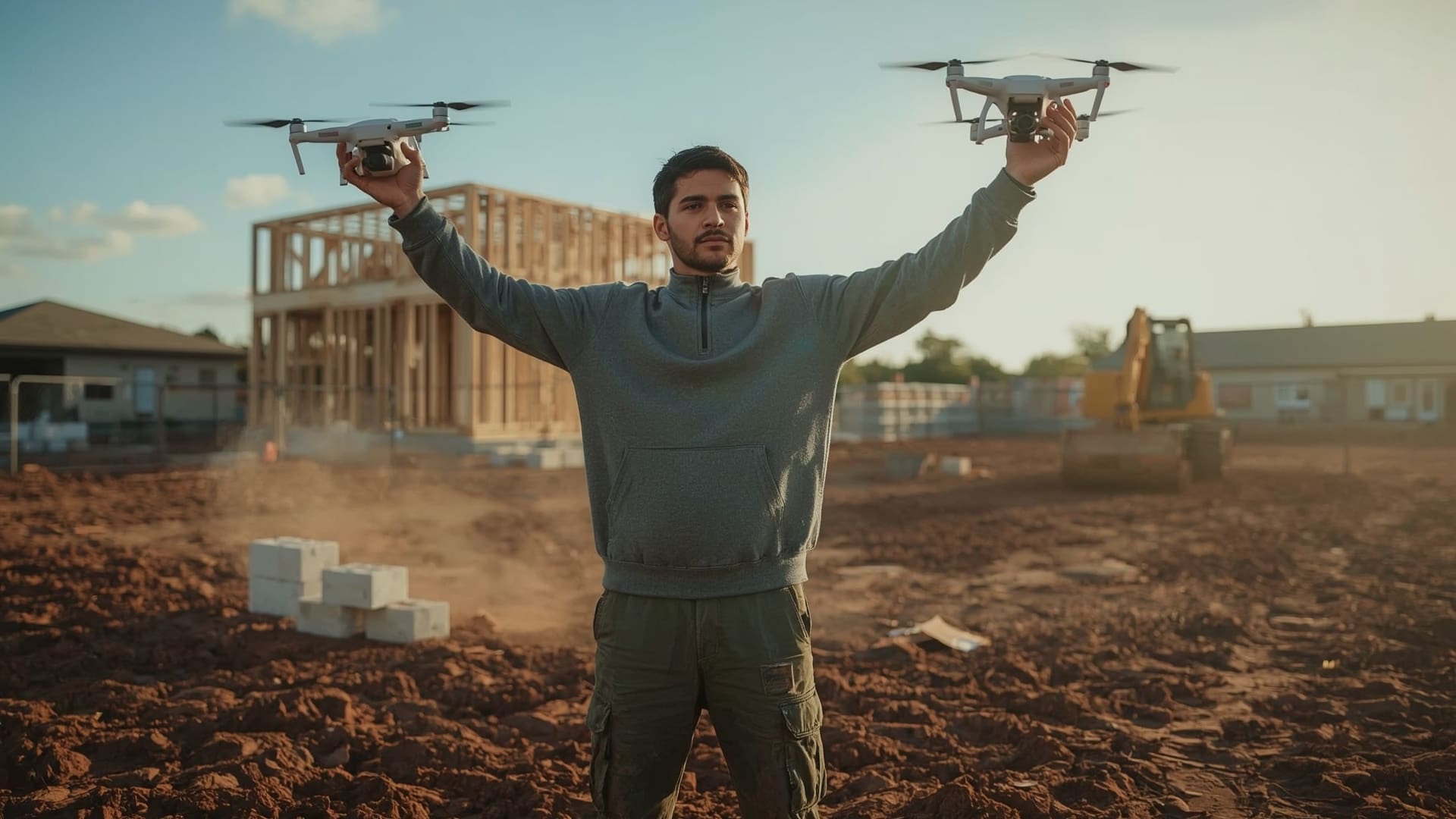
Why Does FAA Part 107 Certification Matter for Commercial Drone Work?
Quick Answer: FAA Part 107 is the federal license required to fly a drone commercially in the United States. Pilots must pass a written aeronautical knowledge test to earn it. Hiring an uncertified operator for commercial work exposes you to fines, voided insurance claims, and unusable footage if legal disputes arise.
The Federal Aviation Administration requires any drone used for commercial purposes — meaning any flight where someone receives compensation — to be operated by a Part 107-certified Remote Pilot. This covers real estate photography, event coverage, inspection work, and every other paid drone service. the FAA’s commercial UAS operator requirements also mandate that drones used commercially are registered with the FAA and marked with their registration number.
Raleigh’s airspace adds another layer of complexity. RDU International Airport and several regional medical helipads create Class C and Class D controlled airspace across much of Wake County. Any flight in those zones requires LAANC authorization obtained before takeoff, not after. A certified pilot understands these boundaries and plans accordingly.
What Happens if You Hire an Uncertified Pilot?
Flying commercially without Part 107 certification is a federal violation. Fines can reach $32,666 per incident. More practically, your project insurance likely won’t cover any incident that occurred during an unlicensed flight. If footage or data from an uncertified flight is ever used in a legal dispute — a construction claim, a property sale, or an insurance claim — its admissibility may be questioned.
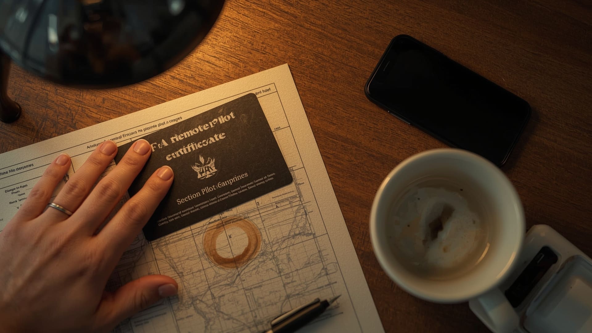
Ask every provider to share their FAA certificate number before booking. Legitimate operators will provide it immediately.
What Equipment Should a Professional Drone Photography Provider Use?
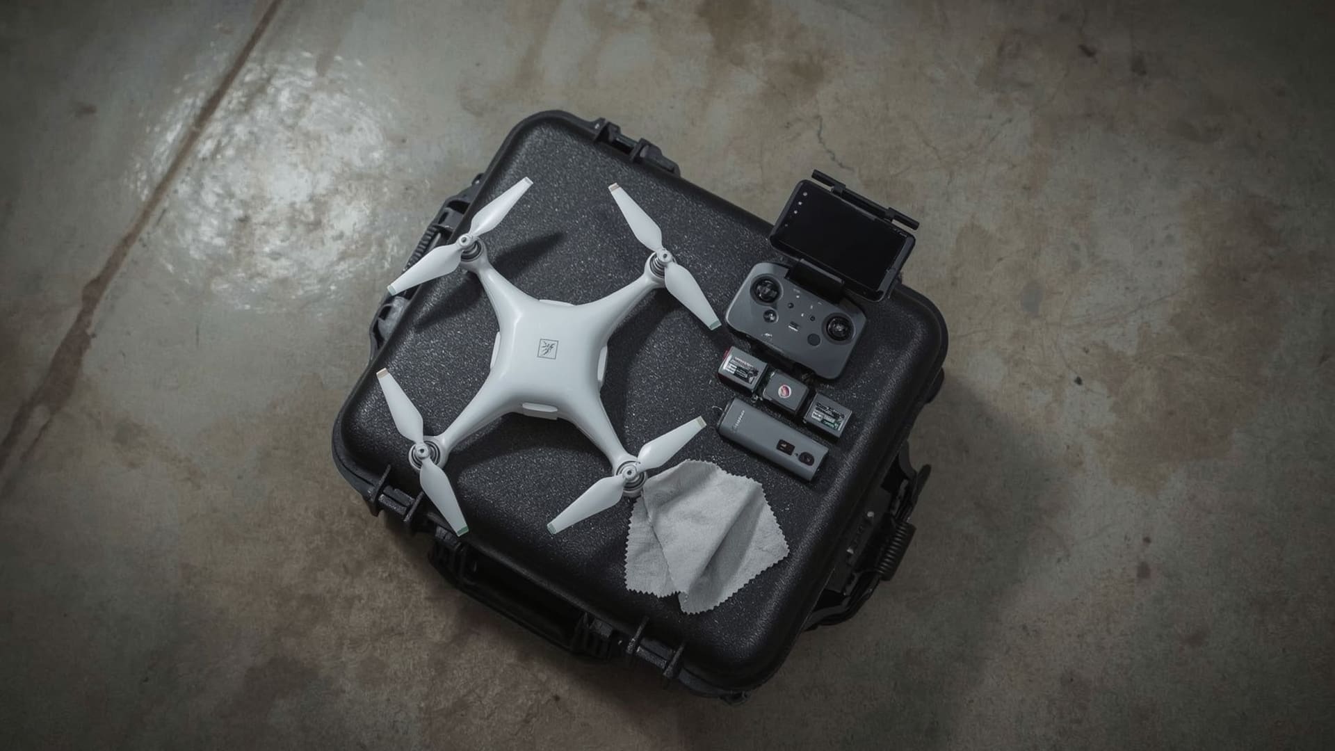
Quick Answer: Professional providers should use commercial-grade platforms like the DJI Mavic 3 Pro or DJI Inspire 3 for photography, thermal sensor platforms for inspections, and RTK GPS drones for mapping. Consumer-grade drones produce noticeably lower quality and lack the stability and redundancy commercial work requires.
| Platform | Best Use Case | Camera / Sensor | Resolution |
|---|---|---|---|
| DJI Mavic 3 Pro | Real estate, events | Hasselblad L-format | 4/3 CMOS, 20MP, 5.1K video |
| DJI Inspire 3 | Commercial film, high-end events | Full-frame Zenmuse X9 | 35MP stills, 8K RAW video |
| DJI Matrice 30T | Inspections, infrastructure | Thermal + zoom combo | 48MP visual, 640×512 thermal |
| DJI Phantom 4 RTK | Mapping, surveying | RTK GPS + 20MP camera | 1cm accuracy, 2cm GSD |
| Autel Evo II Pro V3 | Real estate, construction | 1-inch Sony sensor | 6K video, 20MP photos |
What Should You Look for When Hiring a Drone Service Provider in Raleigh?
Quick Answer: Verify FAA Part 107 certification, liability insurance of at least $1 million, a portfolio matching your use case, and experience with Raleigh airspace. Ask specifically about LAANC authorization processes and turnaround time guarantees before signing any agreement.
Certification and Licensing
Ask for the pilot’s FAA certificate number and verify it. The FAA’s DroneZone system allows anyone to look up registered remote pilots. This takes two minutes and confirms the person you are hiring is legally authorized for commercial work.
Insurance Coverage
Commercial drone operators should carry aviation-specific liability insurance. General business liability policies often exclude UAV operations. Look for a minimum of $1 million per occurrence. For construction, infrastructure, or large event projects, $2 million is a more appropriate benchmark. Ask for a certificate of insurance, not just a verbal confirmation.
Portfolio and Deliverable Samples
Ask to see work from projects similar to yours. A real estate drone portfolio and a construction inspection portfolio require completely different skills and equipment. A pilot who excels at cinematic real estate video may not have the thermal imaging equipment or report-writing experience needed for a commercial inspection.
Turnaround Time and Communication
Get turnaround commitments in writing. For real estate, a 24-hour delivery standard is reasonable and common. For events, three to five business days for edited footage is typical. For inspection reports with annotated images, allow 48 to 72 hours. Providers who can’t give you a specific turnaround window before booking are a red flag.
Field Experience
On a recent commercial inspection in Raleigh, a property management company hired a pilot without verifying their Part 107 status. The pilot flew over a neighborhood near RDU without LAANC authorization, which put the project in a controlled airspace violation. The footage was unusable for their insurance claim because the flight records showed no FAA authorization on file. The company had to rebook the entire inspection, losing two weeks and paying twice. Always request the certificate number before the first flight date.
How Does Raleigh Airspace Affect Drone Operations in Wake County?
Quick Answer: RDU International Airport creates Class C controlled airspace that covers a large portion of central Wake County. Properties within this zone require LAANC authorization for any drone flight. Pilots must obtain digital approval through apps like Aloft or DJI Fly before takeoff.
Wake County sits under some of the most active airspace in North Carolina. The RDU Class C airspace extends outward in concentric rings from the airport, with altitude restrictions that vary by distance. Within five nautical miles of RDU, drones cannot fly above 0 feet without LAANC authorization. Between five and ten nautical miles, altitude limits vary from 100 to 400 feet depending on the specific grid square.
Beyond RDU, WakeMed and Duke Raleigh Hospital helipads create additional temporary flight restriction zones that activate during active medical operations. A qualified local pilot knows these locations and monitors NOTAMs (Notices to Air Missions) to avoid conflicts.
How LAANC Works for Raleigh Drone Flights
LAANC is an automated system that provides near-instant airspace authorization for drone flights below 400 feet in controlled airspace. Pilots submit a flight request through an FAA-approved app, and the system grants or denies authorization within seconds based on the specific location and altitude. According to the FAA, LAANC processes more than 50,000 drone authorization requests each month across the United States, reflecting how routine this process has become for certified operators.
What Deliverables Should You Receive from a Professional Drone Photography Session?
Quick Answer: Standard deliverables include high-resolution edited images (JPG and/or RAW), color-corrected video files (MP4, ProRes, or DNG), and for inspections, a structured PDF report with annotated images. Confirm file formats, resolution specs, and delivery method before booking.
| Project Type | Photo Format | Video Format | Additional Deliverable |
|---|---|---|---|
| Real Estate | JPG, 20MP+ | MP4, 4K minimum | MLS-ready exports, web resolution |
| Event / Wedding | JPG, edited selects | MP4 or ProRes, 4K | Highlight reel, full raw footage option |
| Construction | JPG, geotagged | MP4, 4K date-stamped | Progress log, cloud storage link |
| Inspection | JPG, annotated | MP4, full resolution | PDF report, thermal overlay maps |
| Mapping / Survey | GeoTIFF, orthomosaic | N/A | DEM, 3D point cloud, KMZ file |
How Do Commercial Drone Services Differ from Standard Aerial Photography?
Quick Answer: Commercial drone services go beyond photo and video capture. They include thermal imaging, LiDAR scanning, 3D mapping, and structured data reporting. Standard aerial photography focuses on visual content. Commercial services produce actionable data used for engineering, asset management, and legal documentation.
The distinction matters when you are deciding what kind of provider you need. For a real estate shoot or a wedding, a skilled aerial photographer with a high-quality camera drone is exactly the right fit. For infrastructure assessments, land development, or ongoing construction documentation, you need a provider with specialized sensors, data processing workflows, and reporting capabilities.
Explore the full range of commercial drone services available to businesses in the Triangle, including options for construction documentation, infrastructure assessment, and industrial inspection work.
What Questions Should You Ask Before Booking a Drone Service in Raleigh?
Quick Answer: Ask for FAA certificate number, proof of liability insurance, portfolio samples from similar projects, airspace authorization process, turnaround time guarantee, and whether raw files are included. These six questions filter out unqualified operators quickly and protect your project legally and financially.
Pre-Booking Checklist for Drone Services
- FAA Part 107 certificate number — verify it is current and matches the pilot’s name
- Insurance certificate — must be aviation-specific liability, minimum $1M per occurrence
- Portfolio samples — request work from the same industry or use case as your project
- Airspace authorization plan — confirm they have a LAANC process for any controlled airspace areas
- Deliverable specifications — file formats, resolution, quantity of final images or video length
- Turnaround time in writing — specific business days, not “as soon as possible”
- Weather and reschedule policy — what happens if wind, rain, or airspace restrictions delay the shoot
- Raw file access — will you receive unedited files, or only the final edited versions?
How Do Weather Conditions Affect Drone Photography Shoots in North Carolina?
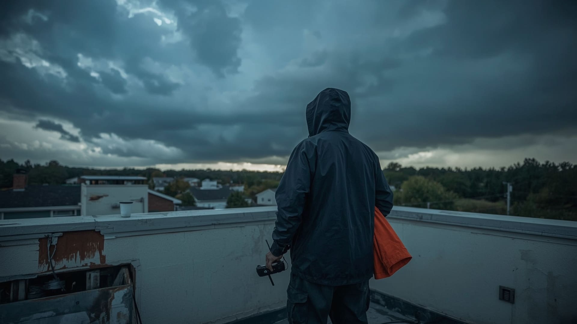
Quick Answer: Most commercial drones cannot fly safely in winds above 20–25 mph or in rain. North Carolina’s spring storm season and summer afternoon thunderstorms frequently cause rescheduling. A professional provider builds weather buffers into their booking process and has a clear reschhedule policy.
Raleigh averages about 45 inches of rain per year, with the highest precipitation in spring and late summer. Wind events are most common from October through March. Professional drone pilots monitor wind speeds at altitude, not just at ground level, since conditions 200 feet up can be dramatically different from what you feel on the ground.
The FAA recommends against flying in winds above 20 knots (23 mph) for most commercial platforms. Research on drone safety in adverse conditions shows that weather-related UAV incidents are among the most common causes of unplanned landings and equipment damage, reinforcing why experienced operators check conditions before every flight.
Always ask your provider how they handle weather delays before you book. The answer tells you a lot about their professionalism and planning process.
Frequently Asked Questions About Drone Photography Services in Raleigh NC
Do I need a permit to have a drone fly over my private property in Raleigh?
Property owners do not need a permit to hire a drone service to fly over their own land. The pilot needs FAA authorization if the flight is in controlled airspace. Wake County does not require additional local permits for commercial drone work, but some municipalities within the county may have ordinances for event-specific flights. Your provider should handle all airspace authorizations as part of their service.
How far in advance should I book a drone photography session?
For real estate, two to five business days is usually sufficient. For events like weddings or corporate gatherings, book three to eight weeks ahead to secure your date and allow time for airspace authorization in controlled zones near RDU. For construction monitoring programs, contact providers at least two weeks before your first scheduled site visit.
Can drones fly at night in Raleigh for event photography?
Yes, but nighttime drone operations require a specific FAA waiver or compliance with Part 107.29, which allows nighttime flight with an anti-collision light visible from three miles. Not all providers hold this authorization. If your event or project requires nighttime aerial coverage, confirm the pilot has the necessary FAA authorization before booking.
What resolution should aerial real estate photos be for MLS listings?
MLS platforms typically accept images at 72 DPI for web display, but professional drone cameras capture at 20MP or higher for full flexibility. Always request high-resolution files (minimum 20MP JPG) even if the platform compresses them. You will need the full resolution versions for print marketing, signage, and future use.
Is drone inspection footage admissible as evidence in insurance claims?
Yes, when captured by an FAA-certified pilot operating within legal airspace boundaries. The flight records, including LAANC authorization logs and GPS metadata embedded in the footage, establish a legally verifiable chain of custody. Footage from uncertified pilots or unauthorized airspace flights may be challenged in claims processes.
What is the difference between a drone video highlight reel and a full event edit?
A highlight reel is typically 60 to 180 seconds of the best aerial moments, edited to music. A full event edit includes comprehensive coverage of the entire event from arrival to conclusion, often running three to ten minutes. Highlight reels are standard deliverables. Full event edits are usually add-ons with additional post-production fees ranging from $150 to $400 depending on event length.