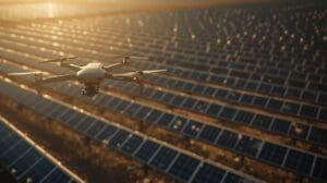
Drone bridge inspection is changing how engineers and infrastructure teams assess structural conditions. Instead of sending workers onto scaffolding, under decks, or into confined spaces, a bridge inspection drone can capture high-resolution imagery from every angle in a fraction of the time. The result is a safer process, a more complete data set, and lower overall project costs.
Traditional manual bridge inspections carry real risks. Workers hang from cables, operate bucket trucks over traffic, or crawl beneath decks above fast-moving water. Aerial bridge survey methods remove most of those hazards while producing detailed visual records that support better maintenance decisions. Whether you manage a single overpass or a regional network of structures, drone technology offers a smarter path forward.
Ready to learn more? Explore our professional drone inspection services to see how we support infrastructure teams across North Carolina.
Why Drone Bridge Inspection Is Growing Across the Industry
Bridge infrastructure across the United States is aging. Many structures were built decades ago and require frequent, detailed evaluations to stay safe. Manual inspections are time-consuming, expensive, and put trained workers in dangerous positions. Drone technology addresses all three of those problems at once.
A certified drone pilot can survey a bridge from the waterline to the top of its towers without closing lanes or staging heavy equipment. This makes aerial surveys especially valuable in high-traffic corridors where lane closures cost money and cause significant disruption. The speed advantage alone is pushing transportation departments and private owners toward drone-based workflows.
What a Bridge Inspection Drone Actually Captures
Modern bridge inspection drones carry a range of sensor payloads depending on the scope of work. The data collected goes far beyond standard photography and gives engineers a comprehensive structural picture.
- 4K visual imagery: High-resolution photos and video of decks, beams, piers, and abutments.
- Thermal imaging: Infrared sensors detect moisture intrusion, delamination, and hidden voids in concrete that a visual check would miss.
- Photogrammetry data: Overlapping images are processed into accurate 3D point clouds and models of the entire structure.
- Close-proximity video: Pilots can maneuver drones within inches of girders and expansion joints to document cracks, corrosion, and spalling in detail.
- LiDAR scanning: Light detection and ranging technology produces precise measurements of structural geometry and deformation.
Each data type serves a specific purpose in the inspection report. Combining visual, thermal, and geometric data gives engineers a more complete picture than any single method provides on its own.
How an Aerial Bridge Survey Compares to Traditional Methods
Understanding the difference between drone-based and conventional inspection methods helps decision-makers weigh options correctly. The table below summarizes the key contrasts.
| Factor | Manual Inspection | Drone Inspection |
|---|---|---|
| Worker Safety | High exposure risk | Minimal risk, no personnel at height |
| Traffic Disruption | Lane closures often required | Minimal to none |
| Inspection Speed | Days to weeks | Hours |
| Data Coverage | Limited by access points | Full 360-degree structural access |
| Documentation | Notes and spot photos | Full visual and sensor data archive |
| Repeatability | Varies by inspector | Consistent flight paths, comparable data sets |
The data advantage is significant. When you can fly the same route each inspection cycle, you create comparable records that show structural change over time. That kind of trend analysis is very difficult to replicate with manual methods.
Key Structural Elements a Drone Surveys During a Bridge Inspection
A thorough drone bridge inspection covers every major component of the structure. Pilots and engineers plan flight paths to capture all critical areas systematically.
Deck and Wearing Surface
The top surface of the bridge takes constant wear from traffic, weather, and freeze-thaw cycles. Drones capture wide-area imagery to identify cracking patterns, pothole formation, and surface deterioration across the full deck width.
Superstructure: Girders, Beams, and Trusses
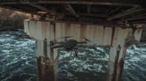
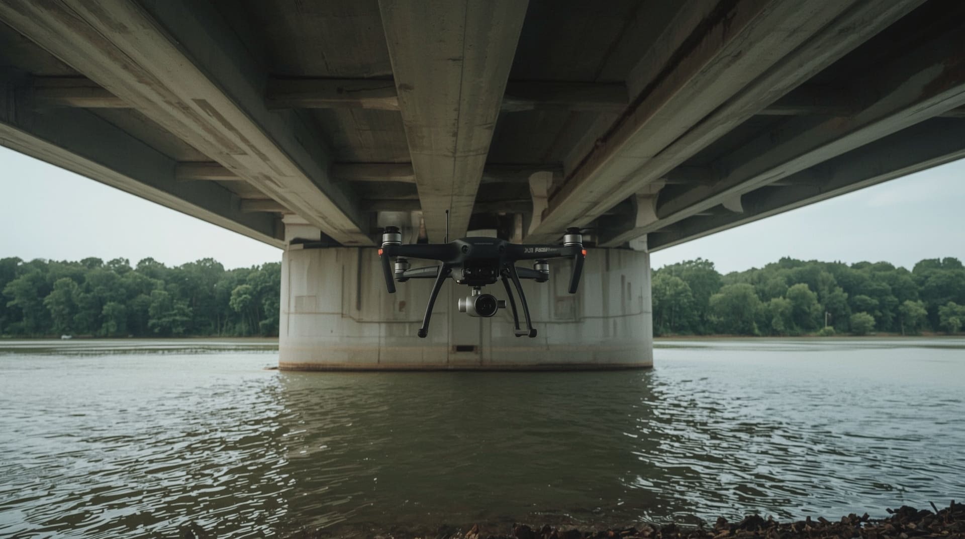
The superstructure carries the load of the deck to the supports below. Drones fly beneath the deck to photograph steel and concrete members for rust, corrosion, section loss, and cracking. These areas are extremely difficult to access safely by hand.
Substructure: Piers and Abutments
Piers sit in or near water and face continuous environmental attack. Drone cameras document scour (the erosion of soil around foundations), impact damage, and concrete deterioration at and below the waterline.
Expansion Joints and Bearings
These components allow the bridge to flex with temperature changes. Drone footage captures joint gaps, debris buildup, and bearing movement that signal potential problems before they become structural failures.
The Safety Case for Replacing Manual Checks with Aerial Surveys
Worker safety is the most compelling reason to adopt drone bridge inspection. Traditional inspectors face falls, traffic exposure, and structural collapse risk. These are not theoretical concerns. Bridge inspection consistently ranks among the most hazardous field jobs in civil engineering.
Drones eliminate the need for workers to hang from snooper trucks, rappel from deck edges, or wade into moving water beneath a structure. The pilot and any on-site observers stay on solid ground the entire time. In North Carolina, where bridges cross rivers, interstates, and active rail corridors, this safety shift matters enormously for every project team.
Beyond protecting workers, reduced traffic disruption also protects the public. Fewer lane closures mean fewer merge-zone accidents. That benefit extends to everyone who drives over or past the bridge during inspection periods.
How Drone Data Supports Engineering Analysis and Reporting

Collecting drone footage is only the first step. The real value comes from how that data is processed and delivered to engineers and asset managers.
After a flight, captured imagery goes through photogrammetry software that stitches thousands of overlapping photos into georeferenced 3D models. Engineers can navigate these models from a desktop, zoom into any surface, and measure crack widths or section dimensions with high accuracy. This process turns raw aerial footage into a usable engineering tool.
Deliverables from a drone bridge inspection typically include:
- Full-resolution annotated image sets organized by structural element
- Thermal analysis reports highlighting subsurface anomalies
- 3D photogrammetric models for measurement and archival
- Condition rating summaries aligned with inspection standards
- Video walkthroughs of each structural component
These outputs can feed directly into bridge management systems, making the transition to drone-based workflows straightforward for most transportation agencies and private owners.
Regulations and Pilot Certification for Bridge Inspection Drones
Operating a drone near bridges requires proper FAA certification and, in many cases, airspace authorization. Pilots must hold an FAA Part 107 Remote Pilot Certificate to fly commercially. Many bridge sites also fall within controlled airspace, near airports, or over navigable waterways that carry additional regulatory considerations.
Working with a certified drone service provider removes compliance risk from your project. A qualified team handles airspace waivers, site safety planning, and all required documentation before a single flight takes place. This is especially relevant in the Raleigh area, where proximity to RDU International Airport and multiple military corridors requires careful airspace coordination.
Insurance coverage is another non-negotiable. A professional drone inspection company carries commercial liability coverage specifically for structural inspection work. Always confirm coverage before hiring any provider.
Choosing the Right Drone Inspection Provider for Your Bridge Project
Not every drone operator has the equipment or experience to conduct a proper structural inspection. The right provider brings together certified pilots, engineering-grade sensors, and a reporting process that meets your project’s standards.
Look for these qualifications when selecting a team:
- FAA Part 107 certification: Required for any commercial drone flight.
- Structural inspection experience: Ask for examples of past bridge or infrastructure work.
- Sensor capability: Confirm the team carries thermal, 4K visual, and photogrammetry payloads.
- Data deliverable format: Ensure outputs match what your engineering team needs.
- Airspace coordination: Verify the provider can manage waivers and authorizations for your site.
- Commercial insurance: Confirm coverage amounts before signing any agreement.
A provider with deep inspection experience will also help you plan the flight scope correctly from the start. Knowing which structural elements to prioritize and which sensor to deploy for each surface saves both time and money on every project.
Final Thoughts on Drone Bridge Inspection
Drone bridge inspection delivers clear advantages over traditional manual methods in safety, speed, coverage, and data quality. The technology is mature, the regulatory framework is established, and providers with real structural inspection experience are available today. For infrastructure owners and transportation agencies across North Carolina and beyond, aerial surveys are no longer a novelty. They are the practical standard.
As bridge infrastructure continues to age and inspection demands grow, adopting drone-based workflows puts your team ahead of the curve. The combination of reduced worker risk, minimal traffic disruption, and richer data sets makes drone inspection one of the most cost-effective decisions you can make for your bridge maintenance program.
Frequently Asked Questions About Drone Bridge Inspection
Can a drone inspection replace a formal NBIS bridge inspection?
The National Bridge Inspection Standards (NBIS) still require a qualified inspector to sign off on official condition ratings. However, drone data can supplement and support the inspection process significantly. Many agencies use drone surveys to gather preliminary data, reducing the time a human inspector must spend on site and improving the quality of findings documented in the formal report.
How long does a drone bridge inspection take?
Most single-span bridges can be fully surveyed in two to four hours of flight time. Larger structures with multiple spans, piers, and complex geometries may require a full day or more. The processing of aerial data into deliverable reports typically takes an additional two to five business days depending on the scope of analysis requested.
What types of defects can a bridge inspection drone detect?
Drones equipped with high-resolution cameras and thermal sensors can detect surface cracking, concrete spalling, steel corrosion, section loss, delamination, moisture intrusion, joint failures, and scour at pier bases. Thermal imaging is particularly effective at identifying subsurface voids and water infiltration that visual inspection alone would miss.
Is drone bridge inspection allowed over active traffic?
Flying a drone over moving vehicles requires specific FAA waivers and careful site safety planning. Many inspections are conducted during low-traffic periods or with coordinated lane control to keep the operation compliant and safe. A professional drone inspection provider will assess site conditions and secure necessary authorizations before any flight over active roadways.
How much does a drone bridge inspection cost compared to traditional methods?
Costs vary based on bridge size, sensor requirements, and reporting scope. In most cases, drone inspections cost less than traditional under-bridge inspections that require snooper trucks, lane closures, and extended crew time. The reduction in mobilization costs and traffic control expenses alone often makes the drone approach more economical, especially for repetitive inspection cycles.