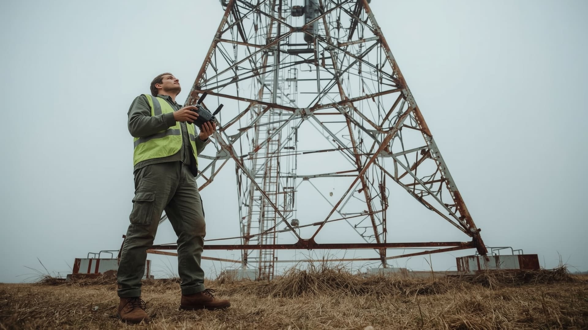
Climbing a cell tower is one of the most dangerous jobs in America. Workers operate at heights between 150 and 2,000 feet, exposed to wind, weather, and equipment that never stops changing. Fatal falls happen every year. Traditional inspections are slow, expensive, and carry real human risk every single time.
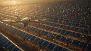
Drone inspection changes that equation entirely. A licensed drone pilot can assess the same tower in a fraction of the time, with high-resolution imagery the climber could never capture from their harness. Telecom companies across North Carolina are already making the switch, and the reasons are hard to argue with.
Key Takeaways
- Drones inspect cell towers up to 75% faster — what takes a crew of climbers a full day can be completed by a drone pilot in 2 to 4 hours.
- Zero climb risk means fewer fatalities — tower climbing is consistently ranked among the most dangerous occupations in the U.S., and drone inspections eliminate the primary hazard entirely.
- High-resolution cameras capture what human eyes miss — thermal imaging, 4K zoom lenses, and close-proximity flight detect hairline cracks, corrosion, and hardware failures invisible from ground level.
- Deliverables are digital and immediate — annotated photo reports, video walkthroughs, and thermal overlays can be shared with engineers the same day inspection ends.
- FAA Part 107 certification governs commercial drone operations — only licensed pilots operating under Part 107 authority can legally perform commercial cell tower inspections.
- North Carolina telecoms are adopting aerial inspection at scale — dense tower networks in urban corridors like Charlotte, Raleigh, and the Research Triangle are driving regional demand.
What Is Cell Tower Drone Inspection?
Quick Answer: Cell tower drone inspection uses FAA-licensed pilots flying camera-equipped drones to photograph and assess tower structures, antennas, mounts, and hardware. It replaces or supplements traditional climber-based inspection, reducing risk, time, and cost significantly.
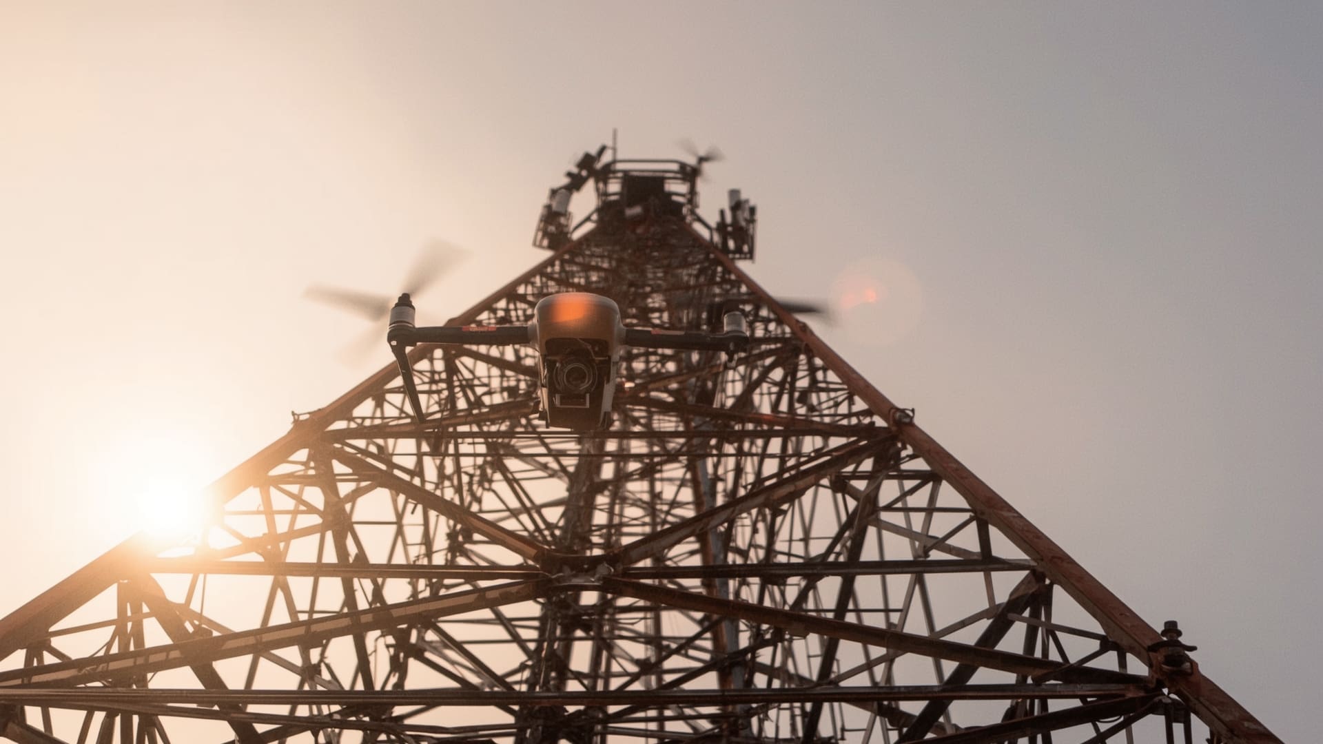
A cell tower drone inspection is a structured aerial assessment of a telecommunications tower using an unmanned aerial vehicle (UAV). The drone is piloted by an FAA Part 107 certified operator who flies close to the tower structure, capturing high-resolution still images, 4K video, and in many cases, thermal imagery of electrical components.
The inspection follows a defined flight path. The pilot typically begins at the base, works upward in a spiral or grid pattern, and captures each section of the tower from multiple angles. Nothing on the structure goes unchecked if the inspection plan is built correctly.
The raw data collected during the flight is processed into a structured inspection report. Engineers, site managers, and maintenance teams use this report to prioritize repairs, schedule maintenance windows, and track structural changes over time.
How Does Drone Inspection Differ from Traditional Climbing?
Traditional tower inspection requires a certified climber to physically ascend the structure. The climber carries tools and a camera, documents what they can see from their position, and descends. The process is slow, physically demanding, and inherently dangerous.
A drone pilot stands on the ground the entire time. The UAV does the climbing. The camera sees everything the pilot directs it to see, including angles and positions a climber physically cannot reach safely. The result is more comprehensive documentation with zero fall risk.
Why Is Drone Inspection Safer Than Tower Climbing?
Quick Answer: Tower climbing fatality rates are among the highest of any U.S. occupation. Drone inspections remove the human body from the hazard zone entirely. No climb means no fall risk, no weather exposure at altitude, and no risk of contact with energized equipment.
The telecommunications tower industry has one of the highest worker fatality rates per capita in the United States. Falls from height account for the vast majority of these deaths. Even with proper safety gear and training, the risk is never zero when a person is attached to a structure 500 feet in the air.
Drones eliminate the primary hazard. The pilot stays on the ground. The aircraft absorbs the exposure risk. If the drone encounters wind, interference, or a mechanical failure, the pilot lands it. Nobody gets hurt.
What Environmental Conditions Affect Drone Safety?
Wind speed is the most critical factor. Most commercial inspection drones are rated for stable operation in winds up to 25 to 30 mph. Pilots monitor real-time weather data before and during every flight. Operations are grounded when conditions exceed safety thresholds.
Rain, fog, and ice reduce sensor performance and create navigational risks. Responsible operators follow no-fly protocols for adverse weather. These are not optional guidelines — they are part of FAA compliance and standard operating procedures.
What Components Does a Cell Tower Drone Inspection Cover?
Quick Answer: A complete cell tower drone inspection covers the structural frame, mounting hardware, antenna arrays, coaxial cable runs, grounding systems, lighting systems, and any visible corrosion or physical damage from base to apex. Thermal cameras also capture heat signatures in electrical components.
Structural Assessment
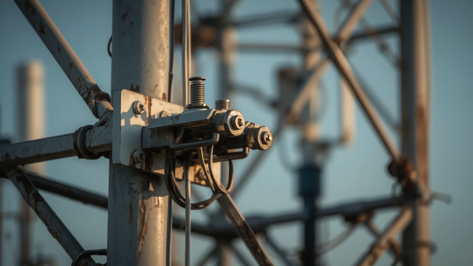
The tower’s structural frame is the first priority. Drones capture close-range images of steel members, welds, bolts, and cross-bracing. Pilots look for signs of corrosion, metal fatigue, bent members, and missing hardware. These structural issues, if missed, can escalate into catastrophic failures during high-wind events.
Antenna and Mount Inspection
Cell towers carry multiple antenna arrays from different carriers. Each antenna is mounted on a separate bracket, aligned to a specific azimuth (direction) and tilt angle. Drone cameras verify that mounts are intact, antennas are properly aligned, and no physical damage has occurred since the last inspection cycle.
Coaxial Cable and Line Assessment
Coaxial cables run from antennas down the tower to equipment at the base. Drones inspect cable routing for signs of abrasion, improper bundling, broken cable hangers, and moisture ingress points. Cable damage directly affects signal performance, making this a high-priority inspection area for network operators.
Lighting System Verification
Towers above a certain height are required by the FAA to display aircraft warning lights. Drones can visually verify light fixture condition, check for burned-out bulbs, and document any physical damage to light mounts. This is a compliance-critical component carriers cannot ignore.
Grounding System Review
Grounding systems protect tower equipment from lightning damage. Drones inspect ground wire routing, connection points, and any signs of disconnection or physical damage. While a drone cannot verify electrical continuity directly, visual inspection of grounding hardware identifies obvious failures for follow-up testing.
What Equipment Do Drone Pilots Use for Tower Inspections?
Quick Answer: Pilots use enterprise-grade UAVs with 4K cameras, optical zoom lenses, and thermal sensors. Popular platforms include the DJI Matrice series and the Autel EVO II Pro. Thermal cameras help locate heat anomalies in electrical components that standard lenses cannot detect.
| Equipment Type | Common Platform / Tool | Key Specification | Primary Use |
|---|---|---|---|
| Inspection UAV | DJI Matrice 300 RTK | Max altitude: 7,000 m | Wind resistance: 15 m/s | Primary flight platform for close-range inspection |
| Optical Camera | DJI Zenmuse H20 | 20 MP | 23x optical zoom | High-resolution structural and hardware photography |
| Thermal Camera | DJI Zenmuse H20T | 640×512 IR resolution | Temperature sensitivity: <0.05°C | Heat anomaly detection in electrical and antenna components |
| Consumer Inspection UAV | Autel EVO II Pro | 6K camera | 40 min flight time | Smaller tower sites and preliminary visual surveys |
| Flight Planning Software | DroneDeploy / Pix4D | Automated waypoint routing | RTK GPS integration | Repeatable flight paths for change-detection analysis |
| Report Delivery Software | Scopito / Tower Pro | Cloud-based | Annotation tools | Issue severity tagging | Structured inspection report delivery to clients |
How Long Does a Cell Tower Drone Inspection Take?
Quick Answer: A standard cell tower drone inspection takes 2 to 4 hours on-site, including setup, flight, and data review. Traditional climber inspections for the same tower typically take 6 to 10 hours or more. Complex multi-carrier towers may extend drone inspection time to half a day.
Flight time for a single tower is typically 30 to 90 minutes depending on tower height, number of antenna arrays, and the level of detail required. The remaining time covers pre-flight safety checks, airspace verification, equipment calibration, and post-flight data review on-site.
Crews that schedule multiple towers in one day can typically complete 3 to 5 inspections, depending on site spacing. This is rarely possible with traditional climbing crews, who may complete one complex tower inspection per day.
How Much Does Cell Tower Drone Inspection Cost?

Quick Answer: Cell tower drone inspection typically costs $300 to $800 per tower for a standard visual inspection. Thermal imaging adds $150 to $400. Traditional climbing inspections for the same scope often run $1,500 to $3,500 per tower, making drones significantly more cost-efficient at scale.
| Inspection Method | Cost Per Tower | Time on Site | Deliverable Quality | Risk Level |
|---|---|---|---|---|
| Drone Visual Inspection | $300 to $800 | 2 to 4 hours | 4K imagery, annotated PDF report | Minimal (no climb) |
| Drone with Thermal Imaging | $450 to $1,200 | 3 to 5 hours | RGB + thermal overlay, priority issue flags | Minimal (no climb) |
| Traditional Climber Inspection | $1,500 to $3,500 | 6 to 10 hours | Photo documentation, written notes | High (active fall risk) |
| Hybrid (Drone + Climber) | $1,200 to $2,500 | 5 to 8 hours | Full visual survey + hands-on hardware verification | Moderate (limited climb) |
For telecom companies managing portfolios of 50, 100, or 500 towers, the cost savings compound quickly. A 100-tower portfolio inspected by drone instead of traditional climbers can save $100,000 to $270,000 in a single inspection cycle.
What Does a Drone Inspection Report Include?
Quick Answer: A drone inspection report includes annotated high-resolution photographs, flagged issues with severity ratings, GPS-tagged image locations, thermal overlays where applicable, and a summary of findings prioritized by urgency. Reports are typically delivered as a PDF or through cloud-based inspection software within 24 to 48 hours.
How Are Issues Classified in the Report?
Most inspection service providers use a tiered severity system. Critical issues require immediate action and may require the tower to be taken offline. High-priority issues need attention within 30 to 90 days. Low-priority items are flagged for monitoring and addressed in the next scheduled maintenance cycle.
Each flagged item includes a GPS-tagged image, a written description, the specific location on the tower, and a recommended action. This structure allows engineers and site managers to assess findings without re-visiting the site.
Can Inspection Reports Be Used for Regulatory Compliance?
Yes. Many carriers use drone inspection reports to document compliance with FCC structural integrity requirements and local permit conditions. The annotated photographs serve as a dated, georeferenced record of the tower’s condition. This documentation holds up in regulatory audits and can support insurance claims when damage is identified after weather events.
What Are the FAA Regulations for Cell Tower Drone Inspections?
Quick Answer: Commercial drone inspections fall under FAA Part 107 rules. The pilot must hold a Remote Pilot Certificate, keep the drone within visual line of sight, stay below 400 feet above ground unless operating near a structure, and obtain airspace authorization for controlled airspace near airports.
| Requirement | Specification | Relevance to Tower Inspection |
|---|---|---|
| Pilot Certification | FAA Remote Pilot Certificate (Part 107) | All commercial operators must hold valid certification |
| Altitude Limit | 400 feet AGL standard; up to 400 feet above structure when within 400 feet of it | Allows operations near tall towers above standard ceiling |
| Visual Line of Sight (VLOS) | Pilot must maintain unaided visual contact with UAV | Requires positioning for sightlines on tall structures |
| Airspace Authorization | Required in Class B, C, D, and E surface airspace via LAANC | Towers near airports require advance authorization |
| Daylight Operations | Civil twilight to civil twilight (waiver available for night) | Most inspections scheduled during standard daylight hours |
| Maximum Airspeed | 100 mph (87 knots) | Not a limiting factor in inspection operations |
LAANC (Low Altitude Authorization and Notification Capability) is the FAA’s automated airspace authorization system. Pilots near airports use it to request and receive near-instant approval for operations. Without LAANC approval in controlled airspace, a commercial inspection is illegal regardless of the pilot’s certifications.
Why Are North Carolina Telecom Companies Switching to Drone Inspections?
Quick Answer: North Carolina’s dense urban tower networks, 5G infrastructure build-out, and liability concerns are driving adoption. Cities like Charlotte, Raleigh, and Durham have hundreds of towers requiring regular inspection, and drone programs reduce both cost and worker compensation exposure significantly.
North Carolina’s telecom infrastructure is among the fastest-growing in the Southeast. The state’s dense population corridors along Interstate 85 and Interstate 40, combined with heavy rural coverage demands, create a large and geographically spread tower portfolio for every major carrier operating in the state.
Carriers managing towers in the Research Triangle region face additional pressure. Technology companies and government contractors in the area require highly reliable network uptime. Tower failures or degraded performance create downstream liability. Faster, more frequent inspection cycles made possible by drones help carriers maintain performance standards before small issues become network-level problems.
How Does 5G Infrastructure Expansion Drive Drone Inspection Demand?
5G networks require more towers, more antennas per tower, and more frequent hardware changes than earlier generations. Small cell deployments on rooftops, utility poles, and street furniture add thousands of new inspection points to an already large portfolio.
Traditional climbing crews cannot scale fast enough to keep pace with 5G rollout timelines. Drone inspection programs scale with the portfolio. One licensed pilot can assess multiple sites per day, making aerial inspection the logical solution for infrastructure teams under deadline pressure.
How Do You Choose a Cell Tower Drone Inspection Company?
Quick Answer: Look for FAA Part 107 certification, liability insurance of at least $1 million per occurrence, proven experience with telecom structures, thermal imaging capability, and cloud-based report delivery. Request sample reports and references from past carrier or tower owner clients before signing a contract.
What Questions Should You Ask Before Hiring?
Before you commit to an inspection provider, ask these specific questions:
- Do you carry a current FAA Remote Pilot Certificate and can you provide the certificate number?
- What is your liability insurance coverage per occurrence and per project?
- How many cell tower inspections have you completed in the past 12 months?
- Do you offer thermal imaging as part of your standard inspection package?
- What inspection reporting software do you use, and how are reports delivered?
- How do you handle LAANC authorization for towers in controlled airspace?
- Can you provide a sample inspection report for a similar tower type?
What Are the Red Flags to Watch For?
Any provider who cannot produce their FAA certificate on request is a legal liability. Commercial drone operations without Part 107 authority expose you and the operator to FAA enforcement action and can void your insurance coverage for any incidents during the flight.
Avoid providers who quote unusually low prices without being able to explain their deliverables. A $100 drone flyover is not an inspection — it is a hobbyist flight. Professional inspections include pre-flight planning, structured flight paths, annotated reporting, and cloud-based delivery.
| Evaluation Factor | Minimum Standard | Best Practice |
|---|---|---|
| FAA Certification | Valid Part 107 Remote Pilot Certificate | Current biennial knowledge test on file |
| Liability Insurance | $1 million per occurrence | $2 million aggregate with named insured endorsement |
| Thermal Imaging | Available as add-on | Included in standard inspection package |
| Report Delivery Time | Within 72 hours | Within 24 hours via cloud-based platform |
| Issue Severity Classification | Basic flagging system | 3-tier severity with recommended actions per finding |
| Telecom-Specific Experience | At least 20 tower inspections completed | 100+ inspections with carrier client references available |
What Is the ROI of Switching to Drone Tower Inspection?
Quick Answer: Telecom companies switching from climber inspections to drone programs typically see 50% to 75% reductions in per-tower inspection costs, faster inspection cycles, reduced workers’ compensation exposure, and fewer unplanned outages from missed structural defects detected earlier by aerial imaging.
The financial case for drone inspection goes beyond direct cost savings. Faster inspections mean shorter intervals between assessment cycles. Shorter intervals mean structural problems get caught earlier, before they escalate into equipment failures or emergency repairs that cost far more than a routine inspection.
Workers’ compensation claims from tower climbing injuries represent a real cost that rarely appears in direct inspection budgets. Eliminating climb risk eliminates that exposure. Insurance carriers increasingly recognize drone-first inspection programs as a risk mitigation factor in policy pricing for telecom infrastructure operators.
Frequently Asked Questions
Can drones fully replace tower climbers for all inspections?
Drones replace climbers for visual inspection, documentation, and condition assessment. Some tasks still require physical access, including hands-on hardware replacement, torque verification of bolts, and certain antenna alignment adjustments. Most operators use a hybrid model where drones handle inspection and climbers only ascend when repair work is confirmed.
What happens if a drone crashes during a tower inspection?
A professional drone operator carries liability insurance to cover equipment damage and any third-party property damage from an incident. Reputable providers also carry hull insurance on their aircraft. This is one reason to verify insurance coverage before hiring — an uninsured crash on your site creates liability you did not expect.
How often should a cell tower be inspected by drone?
Most carriers inspect towers annually at a minimum. Towers in high-wind regions, coastal areas, or locations that experienced recent severe weather may require bi-annual inspections. After a major storm event like a hurricane or ice storm, emergency inspections are often ordered for all affected sites within 30 to 72 hours.
Are drone inspection reports admissible for FCC compliance documentation?
Yes. Georeferenced, timestamped inspection reports generated by licensed operators are widely accepted as compliance documentation. The key requirement is that the report is produced by a qualified, certified operator and includes specific issue documentation with GPS-tagged imagery. Always confirm specific requirements with your regulatory counsel.
What is the difference between a visual inspection and a thermal inspection for cell towers?
A visual inspection uses standard cameras to document structural condition, hardware integrity, and visible physical damage. A thermal inspection adds an infrared camera that detects heat signatures. Thermal imaging identifies failing electrical components, overloaded connections, and moisture intrusion points that appear normal under a visual camera but show as temperature anomalies on a thermal sensor.
Do drone inspection services in North Carolina require any state-level permits?
FAA Part 107 is the primary federal requirement. North Carolina does not impose a separate state drone license for commercial operators. However, local ordinances in some municipalities regulate drone operations near public infrastructure, and carriers may have their own site access protocols that require advance coordination with tower owners before any inspection flight begins.