Knowing how to use drone footage in real estate marketing can be the difference between a listing that sits and one that sells. Buyers scroll through dozens of homes online every day, and ground-level photos rarely tell the full story. Aerial video and photos show the property, the yard, the neighborhood, and the surroundings in a single sweep that no standard camera can match.
This guide walks you through every practical step, from planning your first drone shoot to distributing aerial MLS photos across the right channels. Whether you are a solo agent or part of a large brokerage in the Raleigh area, these strategies will help you create listings that stop the scroll and move buyers to action.
Ready to learn more? Explore our full suite of real estate drone services and see how aerial media can elevate your next listing.
Why Drone Video Real Estate Marketing Outperforms Traditional Photography
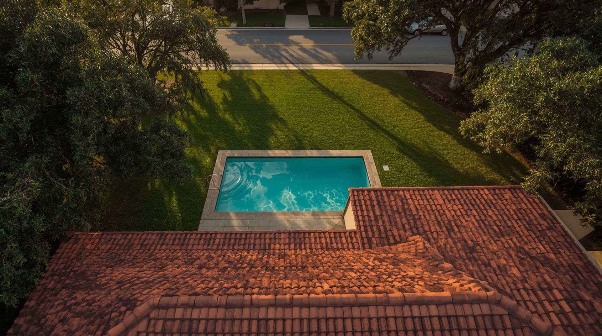
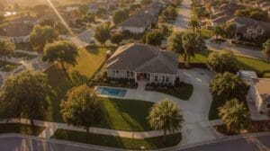
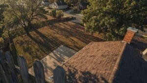
Standard ground-level photos show walls, floors, and fixtures. Drone video shows the whole picture. A well-executed aerial clip reveals the lot size, mature tree line, pool placement, and proximity to parks or roads in just a few seconds. That context builds buyer confidence before they ever schedule a showing.
Listings with aerial imagery also tend to generate more clicks on major real estate portals. More clicks mean more showings, and more showings mean faster offers. For agents competing in active markets, that speed matters enormously.
Aerial content also communicates perceived value. A property filmed from above looks larger, more impressive, and more professionally presented than one with basic smartphone photos. That perception directly influences the price buyers are willing to offer.
Understanding FAA Rules Before You Fly
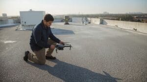
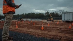
Before any drone takes off over a property, the pilot must follow Federal Aviation Administration (FAA) rules. The FAA is the U.S. government agency that regulates all airspace, including low-altitude commercial drone operations. Any pilot flying for compensation, including real estate photography, must hold a Part 107 Remote Pilot Certificate.
Key compliance points every agent should know include:
- Certified pilot required: Never hire an unlicensed hobbyist for commercial shoots. The liability risk is significant.
- Airspace authorization: Properties near airports or controlled airspace require FAA authorization before flying.
- Altitude limits: Most commercial drone operations must stay at or below 400 feet above ground level.
- Privacy considerations: Avoid capturing neighboring properties in ways that could raise privacy concerns.
Working with a professional drone service handles all of these requirements automatically. You focus on the listing, and the pilot handles the legal and safety side.
Planning the Perfect Real Estate Drone Shoot
A great aerial shoot starts well before the drone leaves the ground. Preparation determines the quality of the final footage, so treat planning as part of the job.
1. Choose the Right Time of Day
The best light for drone video is during the “golden hour,” which is the hour after sunrise or the hour before sunset. The sun is low, shadows are soft, and the warm tone makes every property look inviting. Midday light creates harsh shadows and washed-out colors that are difficult to fix in post-production.
2. Stage the Property for Aerial Viewing
Ground staging rules still apply, but aerial staging adds a few extra steps. Move vehicles off the driveway, cut the grass, trim hedges, and remove any debris from the yard. The drone will capture all of it, so the exterior needs to be as polished as the interior.
3. Define the Shot List in Advance
Coordinate with your drone pilot before the shoot day. A clear shot list prevents missed angles and saves time on location. Standard real estate shot lists typically include:
- An overhead “bird’s eye” view of the full property and lot
- A slow reveal flyover approaching the front facade
- Perimeter orbit showing all four sides of the structure
- Backyard, pool, or outdoor living area close-up
- Neighborhood context showing nearby streets, parks, or water features
4. Plan for Weather Flexibility
Wind, rain, and overcast skies can ground a shoot or ruin the footage. Book your session with a buffer day built in, especially during unpredictable seasons. A professional drone service will monitor conditions and reschedule proactively rather than deliver poor results.
Using Aerial MLS Photos to Maximize Listing Visibility
Aerial MLS photos, meaning still images captured by a drone for use in Multiple Listing Service entries, are one of the highest-impact additions you can make to any listing. MLS platforms rank and display listings based partly on photo quality and count. More high-quality images, including aerials, can improve your position in search results on those platforms.
| Content Type | Best Use | Where to Deploy |
|---|---|---|
| Aerial still photos | MLS listings, print flyers | Zillow, Realtor.com, MLS |
| Aerial video clips | Property tours, social ads | YouTube, Instagram, Facebook |
| Cinematic highlight reel | Agent branding, email campaigns | Website, email, YouTube |
| Neighborhood overview video | Relocation buyers, out-of-state leads | Property website, social media |
Place at least two to three aerial stills near the top of your MLS photo sequence, not buried at the end. Buyers form their first impression within seconds of opening a listing. Lead with your strongest visuals.
Distributing Drone Video Across Marketing Channels
Capturing great footage is only half the job. Where and how you share that footage determines how many buyers actually see it. A strategic distribution plan multiplies the return on every dollar you spend on drone video real estate marketing.
Social Media
Short, dynamic drone clips perform exceptionally well on Instagram Reels, Facebook, and TikTok. Trim your best aerial moment down to 15 to 30 seconds, add captions, and post with location-based hashtags. Video posts receive significantly more organic reach than static image posts on most platforms.
Property Websites and Landing Pages
Build a single-property website or landing page that features the aerial video as the hero element. This gives buyers an immersive first impression and a dedicated URL you can share in email campaigns, text messages, and social ads.
Email Campaigns to Buyer Lists
If you maintain a database of active buyers or past clients, a short email with a thumbnail linking to the property video is one of the most direct ways to generate showing requests. Keep the email brief, lead with the aerial image, and use a clear call to action.
YouTube for Long-Term Search Visibility
Upload the full property video to YouTube with a keyword-rich title and description. YouTube is the second-largest search engine in the world, and property videos can appear in both YouTube and Google search results. This extends the life of your listing content well beyond the sale.
Applying Drone Footage to Commercial Real Estate Listings
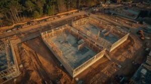
Drone footage is not just for residential homes. Commercial real estate, including office parks, retail centers, industrial buildings, and land parcels, benefits even more from aerial perspectives. A ground-level photo of a 50,000-square-foot warehouse conveys very little. A drone video that orbits the full structure, shows loading docks, parking capacity, and surrounding road access tells the complete story in under two minutes.
For land listings, aerial footage is practically essential. Lot boundaries, topography, and proximity to utilities or roads are nearly impossible to communicate with ground photos alone. An overhead map-style shot combined with a slow orbit gives commercial buyers and their advisors the spatial information they need to evaluate the opportunity.
Common Mistakes Agents Make with Real Estate Drone Content
Even agents who invest in drone footage sometimes undercut their own results by making avoidable mistakes. Knowing these pitfalls in advance will save you time, money, and missed opportunities.
- Using unlicensed pilots: Footage from uncertified pilots can create legal and insurance liability. Always verify Part 107 certification.
- Skipping editing: Raw drone footage needs color grading, stabilization, and music. Unedited clips look unprofessional and reflect poorly on the listing.
- Flying in poor conditions: Gray skies and flat light kill the visual impact of aerial footage. Reschedule rather than settle for subpar results.
- Ignoring audio: A property video with no music or jarring background noise loses viewers quickly. Quality background music keeps buyers engaged.
- Burying aerials in the photo sequence: Aerial stills should lead your MLS gallery, not appear as an afterthought at the end.
- Not repurposing content: One drone shoot can generate MLS photos, a social video, a YouTube upload, and email assets. Reuse everything across channels.
Final Thoughts on How to Use Drone Footage in Real Estate Marketing
Drone footage gives agents a powerful, visual way to show buyers what makes a property worth their attention. From aerial MLS photos that dominate the listing gallery to cinematic property tours shared across social media, the applications are wide and the results are measurable. The investment in professional drone video real estate marketing pays back in faster closings, stronger offers, and a more compelling personal brand.
The Raleigh market is competitive, and buyers have more options than ever. Aerial content helps your listings stand apart from the crowd and gives remote or out-of-state buyers the confidence to move forward. Start with one listing, measure the engagement, and you will quickly see why aerial media has become a standard tool for top-performing agents.
Frequently Asked Questions About How to Use Drone Footage in Real Estate Marketing
Do I need a licensed drone pilot for real estate shoots?
Yes. Any drone flight conducted for commercial purposes, including real estate photography, requires the pilot to hold an FAA Part 107 Remote Pilot Certificate. Hiring an unlicensed pilot exposes you and your client to potential legal and insurance issues. Always ask for proof of certification before booking.
How long does a typical real estate drone shoot take?
Most residential shoots take one to two hours on location, depending on lot size and the number of shots required. Editing and delivery typically add another one to two business days. Commercial or large-acreage properties may require additional flight time and a more detailed editing process.
Can aerial MLS photos be used on all real estate portals?
Yes. Aerial still images are standard JPEG or similar files that upload to any MLS platform, Zillow, Realtor.com, or agent website. There are no special format requirements for aerial photos beyond the general image specs each platform sets for all listing photos.
What types of properties benefit most from drone footage?
Larger homes, properties with significant outdoor features like pools or acreage, waterfront homes, and commercial real estate benefit the most. That said, even modest residential listings gain from at least one or two aerial stills that show the lot, street, and neighborhood context that ground photos cannot capture.
How do I find a qualified drone service for real estate in North Carolina?
Look for a local provider with verified FAA Part 107 certification, a portfolio of real estate work, and experience with both photo and video deliverables. In the Raleigh area, working with a specialist who understands local airspace, permit requirements, and the regional real estate market will give you the best results.