Commercial real estate drone photography gives buyers and tenants a perspective that ground-level photos simply cannot match. A single aerial shot can show your office building, parking capacity, site access, and surrounding amenities all at once. That kind of context moves deals forward.
Whether you manage office parks in Raleigh, retail centers in Cary, or industrial sites across the Triangle, drone photography turns raw square footage into a compelling visual story. Buyers make faster decisions when they can see exactly what they are getting before they ever visit the site.
Ready to learn more? Explore our commercial drone services and see how we help property owners and brokers capture listings that convert.
What Commercial Real Estate Drone Photography Actually Covers
Drone photography for commercial properties goes well beyond snapping a few overhead shots. A professional session captures multiple angles, altitudes, and compositions to tell the full story of a site. The goal is to show the property the way a decision-maker needs to see it.
A typical commercial shoot includes:
- Elevated exterior shots showing the full building footprint and roofline
- Parking and access views highlighting lot size, ingress, and egress points
- Proximity shots showing neighboring roads, retail, transit, and landmarks
- Oblique angles (angled shots taken from a mid-altitude position) that add depth and drama to the facade
- Twilight or golden-hour frames for premium listings that need a visual edge
Each deliverable is professionally edited and ready for MLS uploads, LoopNet listings, investor decks, and marketing campaigns.
Why Commercial Property Aerial Photos Outperform Ground-Level Images
Ground-level photography has real limits on a commercial property. A standard camera can show a lobby or a storefront, but it cannot show a 5-acre site layout or a building’s relationship to the interstate. Commercial property aerial photos solve that problem directly.
Here is why aerial imagery performs better in commercial marketing:
- Scale becomes visible. Buyers understand square footage better when they can see it from above.
- Context is instant. Proximity to highways, airports, and retail corridors reads clearly from the air.
- Competition drops away. Most listings still rely on flat ground shots, so aerial content stands out immediately.
- Investor confidence rises. Site control, boundary lines, and lot configuration are obvious in aerial views.
Listings with aerial photography consistently attract more qualified inquiries. Buyers arrive at showings already informed, which shortens the decision cycle.
| Photo Type | Best Use Case | Key Advantage |
|---|---|---|
| High-altitude overview | Large sites, industrial, land | Shows full site layout and acreage |
| Oblique building shot | Office buildings, retail centers | Highlights facade, signage, and curb appeal |
| Proximity context shot | All commercial property types | Shows location advantages instantly |
| Twilight aerial | Premium listings, mixed-use | Creates aspirational visual impact |
| Parking and access view | Retail, medical, multi-tenant | Demonstrates capacity and traffic flow |
Office Building Drone Photography: What Sets It Apart
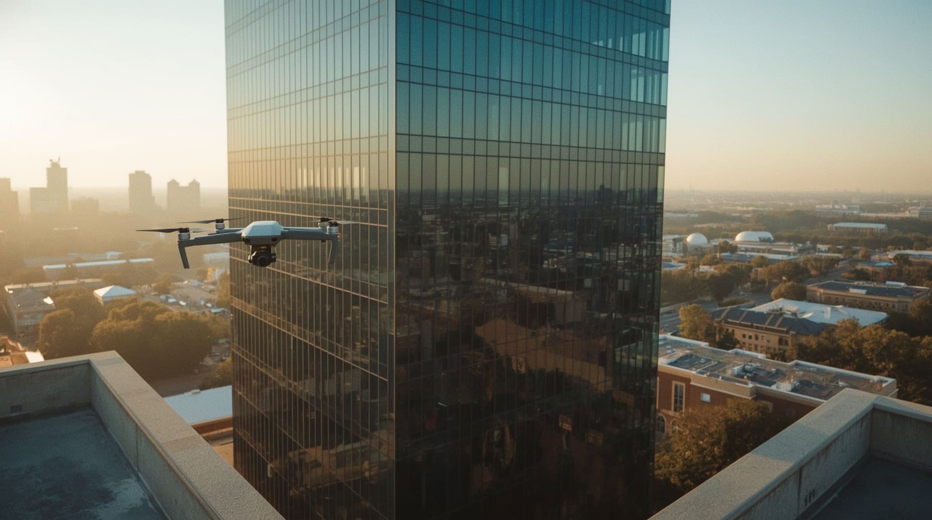
Office buildings present a unique photography challenge. They are tall, often surrounded by other structures, and their appeal depends on both appearance and location. Office building drone photography solves all three challenges at once.
A drone can rise above neighboring structures and capture the building from angles impossible on foot. You get clean roofline shots, glass facade reflections, and the surrounding business district in one frame. That tells a prospective tenant everything they need to know about the address before they schedule a tour.
For multi-story or campus-style office properties, drone footage also works well in video walkthroughs. A slow fly-around combined with interior video creates a full-picture presentation that brokers can send to out-of-state prospects without requiring an in-person visit.
FAA Rules and Airspace Compliance Every Property Owner Should Know
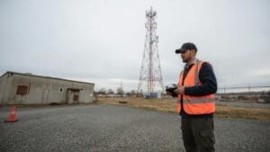
Drone flights in the United States require FAA (Federal Aviation Administration) authorization under Part 107 rules. Any commercial drone operator must hold a valid Part 107 Remote Pilot Certificate. If you hire an unlicensed operator, the footage may not be legally usable and your liability exposure increases.
Key compliance points for commercial drone shoots include:
- Airspace authorization: Properties near airports, heliports, or controlled airspace require digital flight authorization through the FAA’s LAANC system before takeoff.
- Altitude limits: Standard Part 107 flights are capped at 400 feet above ground level unless a waiver is obtained.
- No-fly restrictions: Certain zones, including areas near Raleigh-Durham International Airport, require advance coordination and approval.
- Privacy considerations: A professional operator will avoid capturing neighboring private properties without permission.
Always confirm that your drone photography provider is Part 107 certified and carries commercial liability insurance. This protects the property owner as much as the operator.
How Drone Video Complements Commercial Real Estate Photography
Still photos are the foundation, but drone video adds motion, scale, and emotion that images alone cannot deliver. A short cinematic flyover of your commercial property can anchor a listing page, social media campaign, or investor presentation.
Effective commercial drone video typically includes a smooth ascent reveal, a wide orbit around the structure, and a pull-back that shows the surrounding area. Editors can add text overlays with key property specs, making the video useful as a standalone marketing tool. For high-value listings, pairing aerial video with narration or background music creates a professional, broadcast-quality asset.
Video content also performs well in email campaigns and on platforms like LinkedIn, where commercial real estate professionals actively search for properties. A well-produced flyover can generate more engagement than a dozen static images posted separately.
Choosing the Right Drone Photography Provider for Your Commercial Property
Not every drone operator has experience with commercial real estate. The skill set required for a residential home shoot differs significantly from a large-scale office park or industrial campus. You want a provider who understands both the technical side of drone flight and the marketing goals of a commercial listing.
Look for these qualifications when hiring a commercial drone photographer:
- FAA Part 107 certification with verifiable credentials
- Commercial liability insurance of at least $1 million per occurrence
- A portfolio of commercial properties including buildings similar to yours
- Professional editing capabilities with fast turnaround on deliverables
- Airspace coordination experience especially if your property is near controlled airspace
Ask to see sample deliverables from past commercial shoots before booking. A strong portfolio speaks louder than any marketing claim.
What to Prepare Before Your Commercial Drone Shoot
A little preparation on your end leads to a much better final product. Before the drone operator arrives, take a few steps to set the session up for success.
1. Clear the Site
Remove temporary signage, dumpsters, or equipment from visible areas if possible. The camera captures everything, so a clean site reads as a well-maintained property.
2. Identify Your Key Angles
Talk to your broker or marketing team beforehand. Decide which features matter most, such as loading docks, monument signage, greenspace, or highway visibility. Share that list with your photographer before the shoot.
3. Pick the Right Time of Day
Early morning and late afternoon offer the best natural lighting for commercial exteriors. Midday sun creates harsh shadows that flatten the building’s appearance. Your drone operator can advise on the best window based on your property’s orientation.
4. Confirm Airspace and Property Access
Make sure all relevant parties, including property managers, tenants, and neighboring landowners if needed, are aware of the scheduled flight. Your operator handles airspace authorization, but on-site access is your responsibility.
Final Thoughts on Commercial Real Estate Drone Photography
Commercial real estate drone photography is no longer a premium add-on. It is a baseline expectation for any serious listing in today’s market. Buyers and tenants compare dozens of properties online before making contact, and aerial imagery is often what makes your listing the one they click first.
Working with a certified, experienced drone photographer in the Raleigh area gives you professional-grade imagery that reflects the true value of your property. The investment is small relative to the commissions and lease values at stake, and the results speak directly to the people writing the checks.
Frequently Asked Questions About Commercial Real Estate Drone Photography
How much does commercial real estate drone photography cost?
Pricing varies based on property size, session length, deliverable type, and airspace complexity. Smaller commercial properties typically cost less than large industrial or multi-building campuses. Requesting a custom quote based on your specific property and goals gives you the most accurate number.
How long does a commercial drone photography session take?
Most commercial shoots take between one and three hours on location, depending on property size and the number of angles required. Editing and delivery usually add one to three business days. Rush turnaround options are often available for time-sensitive listings.
Do I need permission from the FAA before flying a drone over my property?
Your drone operator handles FAA authorization, not you as the property owner. However, if the property is near controlled airspace, that authorization must be secured before the shoot date. A licensed Part 107 operator manages this process as part of their service.
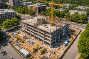
Can drone photography be used for properties that are still under construction?
Yes, and it is often one of the best times to capture aerial imagery. Construction progress shots give investors and future tenants a visual timeline of the project. Aerial photography is also used to document site conditions and milestone completions throughout a build.
What file formats are delivered after a commercial drone shoot?
Most professional operators deliver high-resolution JPEG files for photos and MP4 files for video. RAW image files may be available upon request for clients who want full editing control. Your provider should confirm the format, resolution, and delivery method before the shoot begins.